Old Milepost by the B2011, Folkestone Road, Dover Parish
Introduction
The photograph on this page of Old Milepost by the B2011, Folkestone Road, Dover Parish by C Woodward as part of the Geograph project.
The Geograph project started in 2005 with the aim of publishing, organising and preserving representative images for every square kilometre of Great Britain, Ireland and the Isle of Man.

There are currently over 7.5m images from over 14,400 individuals and you can help contribute to the project by visiting https://www.geograph.org.uk
Old Milepost by the B2011, Folkestone Road, Dover Parish
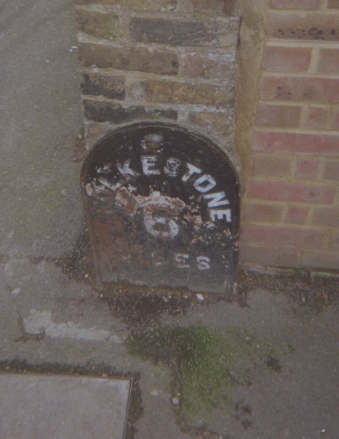
Image: © C Woodward Taken: 25 Mar 2008
Metal plate detached from post by the B2011, in parish of DOVER (DOVER District), Folkestone Road, by No.239; at junction of Underdown Road, on corner of boundary wall, on South side of road. Erected by the Dover & Sandgate turnpike trust in the 19th century. Inscription reads:- FOLKESTONE 6 MILES Milestone Society National ID: KE_FODO06.
Images are licensed for reuse under creativecommons.org/licenses/by-sa/2.0
Image Location
Latitude
51.12327
Longitude
1.296072