Old Direction Sign - Signpost by the B2169 crossroads, Lamberhurst
Introduction
The photograph on this page of Old Direction Sign - Signpost by the B2169 crossroads, Lamberhurst by Milestone Society as part of the Geograph project.
The Geograph project started in 2005 with the aim of publishing, organising and preserving representative images for every square kilometre of Great Britain, Ireland and the Isle of Man.

There are currently over 7.5m images from over 14,400 individuals and you can help contribute to the project by visiting https://www.geograph.org.uk
Old Direction Sign - Signpost by the B2169 crossroads, Lamberhurst
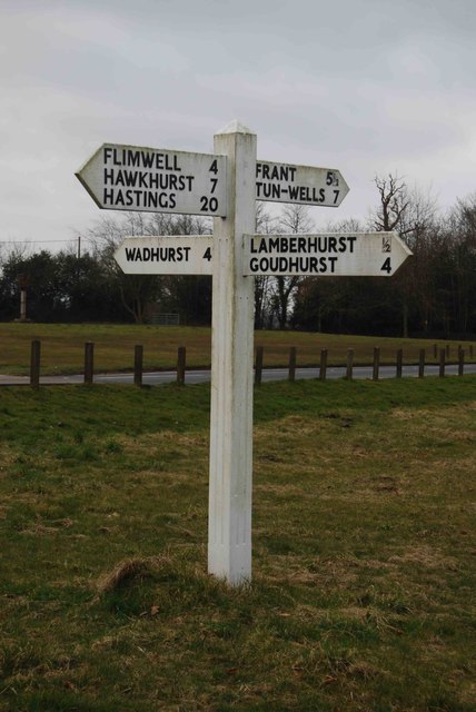
Image: © Milestone Society Taken: Unknown
Black iron cap finial - 3 arms; East Sussex wood by the UC road, in parish of Lamberhurst (Tunbridge Wells District), crossroads of B2169 Furnace Lane and B2100 The Slade, on verge in NW corner of crossroads. Surveyed Milestone Society National ID: KE_TQ6735.
Images are licensed for reuse under creativecommons.org/licenses/by-sa/2.0
Image Location


Leaflet Map data © OpenStreetMap
Latitude
51.094952
Longitude
0.387515