Old Milestone by the A36, near Chadwell Farm, Holmere Common, Whiteparish
Introduction
The photograph on this page of Old Milestone by the A36, near Chadwell Farm, Holmere Common, Whiteparish by Milestone Society as part of the Geograph project.
The Geograph project started in 2005 with the aim of publishing, organising and preserving representative images for every square kilometre of Great Britain, Ireland and the Isle of Man.

There are currently over 7.5m images from over 14,400 individuals and you can help contribute to the project by visiting https://www.geograph.org.uk
Old Milestone by the A36, near Chadwell Farm, Holmere Common, Whiteparish
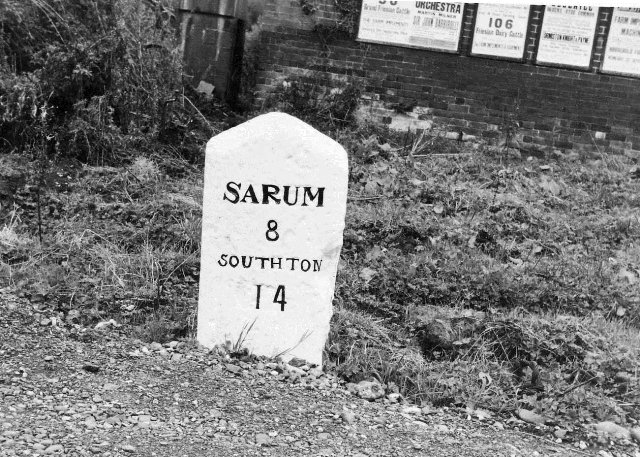
Image: © Milestone Society Taken: Unknown
Southton plate by the A36, in parish of Whiteparish (Salisbury District), near Chadwell Farm, by the road. Lost since 1970. Milestone Society National ID: WI_SASO08.
Images are licensed for reuse under creativecommons.org/licenses/by-sa/2.0
Image Location


Leaflet Map data © OpenStreetMap
Latitude
50.996886
Longitude
-1.655531