East Glasgow motorways from the air
Introduction
The photograph on this page of East Glasgow motorways from the air by Thomas Nugent as part of the Geograph project.
The Geograph project started in 2005 with the aim of publishing, organising and preserving representative images for every square kilometre of Great Britain, Ireland and the Isle of Man.

There are currently over 7.5m images from over 14,400 individuals and you can help contribute to the project by visiting https://www.geograph.org.uk
East Glasgow motorways from the air
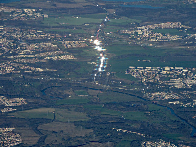
Image: © Thomas Nugent Taken: 3 Dec 2018
The motorways signs on the M73 are reflecting the sunlight in the centre of the photo. This motorway links the M74, which can be seen just beyond the River Clyde, to the M8, which can be seen crossing from left to right in the top half of the photo. The aircraft was above Darvel when the photo was taken.
Images are licensed for reuse under creativecommons.org/licenses/by-sa/2.0
Image Location
Latitude
55.801557
Longitude
-4.115359