The (former) Pineapple
Introduction
The photograph on this page of The (former) Pineapple by Gerald England as part of the Geograph project.
The Geograph project started in 2005 with the aim of publishing, organising and preserving representative images for every square kilometre of Great Britain, Ireland and the Isle of Man.

There are currently over 7.5m images from over 14,400 individuals and you can help contribute to the project by visiting https://www.geograph.org.uk
The (former) Pineapple
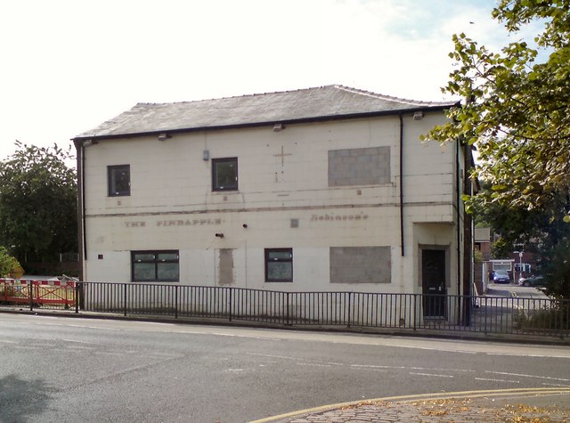
Image: © Gerald England Taken: 20 Jul 2018
Former Robinsons pub on the corner of High Street and Kenworthy Street. Compare with view in 2013 Image when plans to turn it into an Islamic centre for education and prayer were turned down https://www.manchestereveningnews.co.uk/news/greater-manchester-news/plans-build-stalybridge-tameside-mosque-6310947 I'm given to understand it will now probably be converted into housing.
Images are licensed for reuse under creativecommons.org/licenses/by-sa/2.0
Image Location
Latitude
53.480599
Longitude
-2.056467