Brighton Lines
Introduction
The photograph on this page of Brighton Lines by Ian Capper as part of the Geograph project.
The Geograph project started in 2005 with the aim of publishing, organising and preserving representative images for every square kilometre of Great Britain, Ireland and the Isle of Man.

There are currently over 7.5m images from over 14,400 individuals and you can help contribute to the project by visiting https://www.geograph.org.uk
Brighton Lines
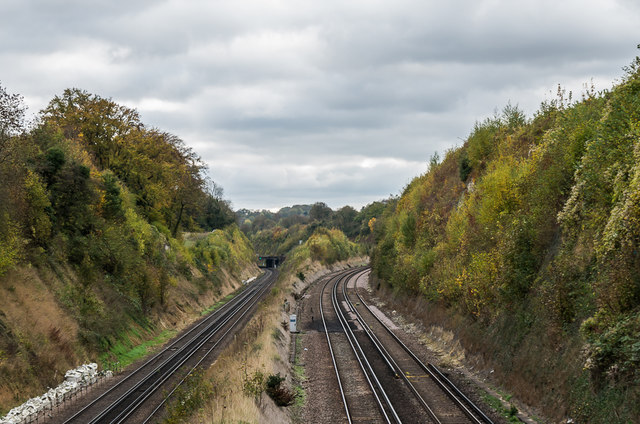
Image: © Ian Capper Taken: 27 Oct 2018
The Brighton Lines from Woodplace Lane Bridge. On the left is the original Brighton Line through Redhill, built in 1841, and on the right is the 1899 Quarry Line, bypassing Redhill. In the distance is the bridge where the latter crosses the former, with the Quarry Line running to the west of the original line until they meet again near Earlswood.
Images are licensed for reuse under creativecommons.org/licenses/by-sa/2.0
Image Location
Latitude
51.305903
Longitude
-0.146639