Roundhouse remains above Achtercairn
Introduction
The photograph on this page of Roundhouse remains above Achtercairn by valenta as part of the Geograph project.
The Geograph project started in 2005 with the aim of publishing, organising and preserving representative images for every square kilometre of Great Britain, Ireland and the Isle of Man.

There are currently over 7.5m images from over 14,400 individuals and you can help contribute to the project by visiting https://www.geograph.org.uk
Roundhouse remains above Achtercairn
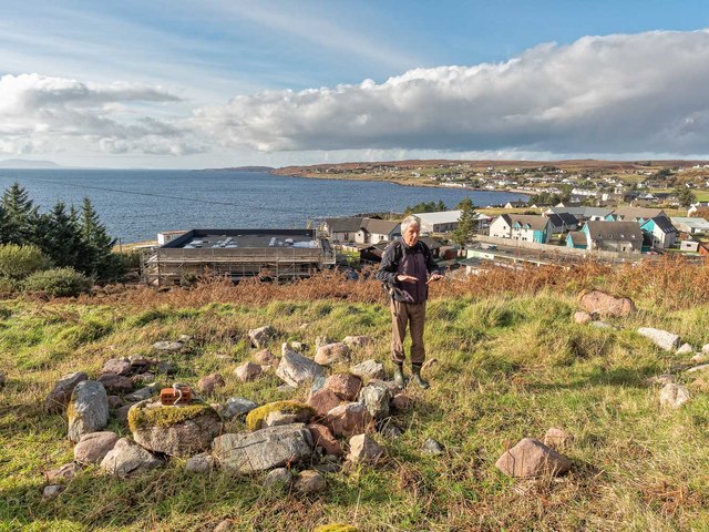
Image: © valenta Taken: 15 Oct 2018
Recently discovered roundhouse, viewed during a tour which was part of the Highland Archaeology Festival. The flat-roofed building below the roundhouse is to be the site of the new Gairloch Heritage Museum, formerly an Anti-aircraft Operations Room. After that, it became a council roads depot and is now being transformed into a museum. http://www.gairlochheritagemuseum.org/redevelopment.html
Images are licensed for reuse under creativecommons.org/licenses/by-sa/2.0
Image Location
Latitude
57.725539
Longitude
-5.687625