Chagford houses [2]
Introduction
The photograph on this page of Chagford houses [2] by Michael Dibb as part of the Geograph project.
The Geograph project started in 2005 with the aim of publishing, organising and preserving representative images for every square kilometre of Great Britain, Ireland and the Isle of Man.

There are currently over 7.5m images from over 14,400 individuals and you can help contribute to the project by visiting https://www.geograph.org.uk
Chagford houses [2]
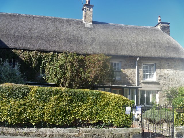
Image: © Michael Dibb Taken: 26 Sep 2018
The mid/late 17th century building was a coaching inn but was converted into domestic accommodation in the late 19th century. It now comprises a house, Lydstone, and a cottage, Kings Arms Cottage. Listed, grade II, with details at: https://historicengland.org.uk/listing/the-list/list-entry/1326026
Images are licensed for reuse under creativecommons.org/licenses/by-sa/2.0
Image Location
Latitude
50.673244
Longitude
-3.840567