Salisbury Villa, Epaul Lane
Introduction
The photograph on this page of Salisbury Villa, Epaul Lane by John Baker as part of the Geograph project.
The Geograph project started in 2005 with the aim of publishing, organising and preserving representative images for every square kilometre of Great Britain, Ireland and the Isle of Man.

There are currently over 7.5m images from over 14,400 individuals and you can help contribute to the project by visiting https://www.geograph.org.uk
Salisbury Villa, Epaul Lane
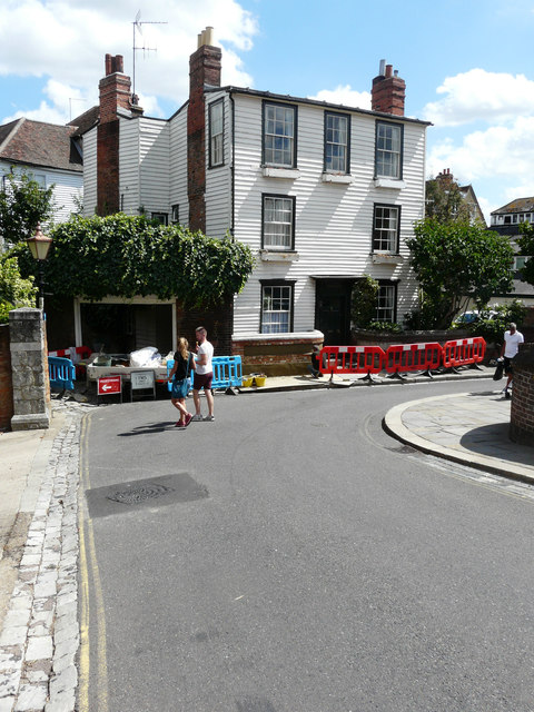
Image: © John Baker Taken: 31 Jul 2018
It is a grade II listed house, which dates from the early 19th century but possibly incorporates earlier work. It is weatherboarded throughout and has lead roofs. The low brick wall with recessed panels, stone plinth and coping, curved to either side of the central doorway, is included in this listing. https://britishlistedbuildings.co.uk/101299662-salisbury-villa-with-attached-wall-to-front-rochester-west-ward#.W4Go7f6Wzcc In this view, it appears that the left hand side of the brick wall has been rebuilt and a man is applying mortar between the brickwork.
Images are licensed for reuse under creativecommons.org/licenses/by-sa/2.0
Image Location
Latitude
51.38996
Longitude
0.50289