Ashcombe Toll House
Introduction
The photograph on this page of Ashcombe Toll House by Simon Carey as part of the Geograph project.
The Geograph project started in 2005 with the aim of publishing, organising and preserving representative images for every square kilometre of Great Britain, Ireland and the Isle of Man.

There are currently over 7.5m images from over 14,400 individuals and you can help contribute to the project by visiting https://www.geograph.org.uk
Ashcombe Toll House
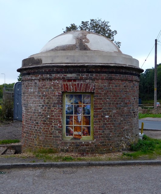
Image: © Simon Carey Taken: 19 Aug 2018
Curious relic from the age of the turnpike. Located at the original junction of the A27 and Ashcombe Hollow, the former has been moved few yards to the north the latter to the right has now been blocked off and a new route takes the lane down to Ashcombe Farm Roundabout. Originally there was a pair but the northern one has been lost to road widening. The existence of fireplaces within the structure has lead some to believe this was the domestic part of the tollgate, the collection area having been lost over time. A door is on the northern side and there are two windows either side, the roof was originally bricked in a circular fashion but was stolen in the 1940s before East Sussex County Council restored it in the 1950s. The tollgate opened in 1820 and probably went into disuse when the turnpike was wound up in 1871, after that ownership became a little blurred and was claimed by Sussex Heritage Society in 1996 and has never been contested. The mural was added in the last few years.
Images are licensed for reuse under creativecommons.org/licenses/by-sa/2.0
Image Location
Latitude
50.866333
Longitude
-0.026672