Benchmark - St Andrews, 55 South Street
Introduction
The photograph on this page of Benchmark - St Andrews, 55 South Street by Richard Law as part of the Geograph project.
The Geograph project started in 2005 with the aim of publishing, organising and preserving representative images for every square kilometre of Great Britain, Ireland and the Isle of Man.

There are currently over 7.5m images from over 14,400 individuals and you can help contribute to the project by visiting https://www.geograph.org.uk
Benchmark - St Andrews, 55 South Street
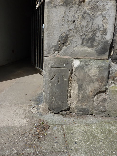
Image: © Richard Law Taken: 17 May 2018
Quite possibly this was cut by the OS in a very early survey of the town, as it's shown on the map of 1895 at 66 ft above sea level, but it no longer features on the OS database. It's certainly of an OS style.
Images are licensed for reuse under creativecommons.org/licenses/by-sa/2.0
Image Location
Latitude
56.339669
Longitude
-2.792915