4 & 5, The Droveway
Introduction
The photograph on this page of 4 & 5, The Droveway by John Baker as part of the Geograph project.
The Geograph project started in 2005 with the aim of publishing, organising and preserving representative images for every square kilometre of Great Britain, Ireland and the Isle of Man.

There are currently over 7.5m images from over 14,400 individuals and you can help contribute to the project by visiting https://www.geograph.org.uk
4 & 5, The Droveway
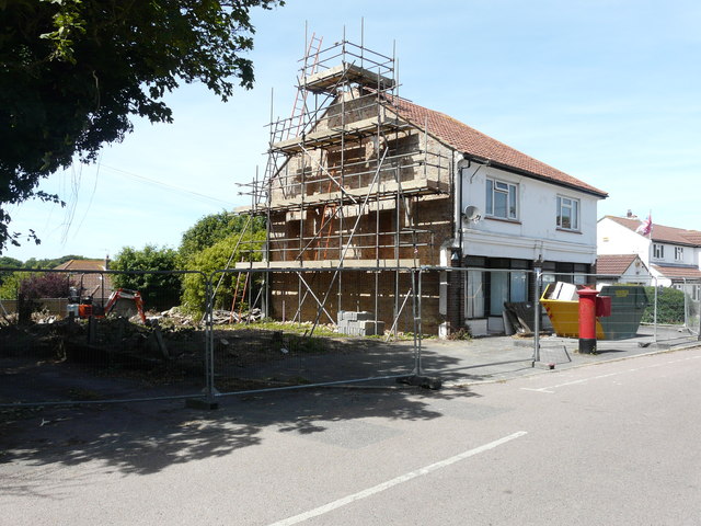
Image: © John Baker Taken: 24 Jun 2018
Planning permission has been granted by Dover District Council under application number DOV/16/00007 for the “erection of 2 semi-detached dwellings with integral carports and attached private garage; erection of 1 attached dwelling; conversion of existing ground floor shop into a self-contained flat, and associated parking and landscaping (existing garages to be demolished)”. The new houses are to be erected beside and at the back of the existing building. These images show Image in 2012 and Image in 2020.
Images are licensed for reuse under creativecommons.org/licenses/by-sa/2.0
Image Location
Latitude
51.150826
Longitude
1.378459