St Matthias Park, Bristol
Introduction
The photograph on this page of St Matthias Park, Bristol by Derek Harper as part of the Geograph project.
The Geograph project started in 2005 with the aim of publishing, organising and preserving representative images for every square kilometre of Great Britain, Ireland and the Isle of Man.

There are currently over 7.5m images from over 14,400 individuals and you can help contribute to the project by visiting https://www.geograph.org.uk
St Matthias Park, Bristol
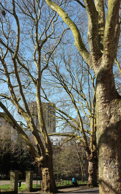
Image: © Derek Harper Taken: 5 Apr 2018
Another view of the tree-lined road shown in Image], with an entrance to the park with the same name as the street. Beyond are three levels of buildings: St Matthias House (flats), Phoenix Court (student accommodation), and then Castlemead, Bristol's tallest building.
Images are licensed for reuse under creativecommons.org/licenses/by-sa/2.0
Image Location
Latitude
51.457408
Longitude
-2.582572