116, Cheriton Road
Introduction
The photograph on this page of 116, Cheriton Road by John Baker as part of the Geograph project.
The Geograph project started in 2005 with the aim of publishing, organising and preserving representative images for every square kilometre of Great Britain, Ireland and the Isle of Man.

There are currently over 7.5m images from over 14,400 individuals and you can help contribute to the project by visiting https://www.geograph.org.uk
116, Cheriton Road
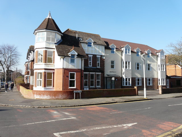
Image: © John Baker Taken: 22 Feb 2018
Planning permission was approved, with conditions, by Folkestone and Hythe District Council under application number Y14/0834/SH for the “change of use and conversion of the former residential care home into 9 self-contained flats, including the erection of a rear extension and front glazed entrance porch, following the removal of existing rear extensions and fire escapes, together with other external alterations to the building”. The building has been given the name “Julian House”, which can be seen above the front entrance in Julian Road, together with the numbers 1-9 (which refer to the flats that are contained within). This image of Image was taken in January 2016.
Images are licensed for reuse under creativecommons.org/licenses/by-sa/2.0
Image Location
Latitude
51.08382
Longitude
1.166204