Park Road
Introduction
The photograph on this page of Park Road by Alan Walker as part of the Geograph project.
The Geograph project started in 2005 with the aim of publishing, organising and preserving representative images for every square kilometre of Great Britain, Ireland and the Isle of Man.

There are currently over 7.5m images from over 14,400 individuals and you can help contribute to the project by visiting https://www.geograph.org.uk
Park Road
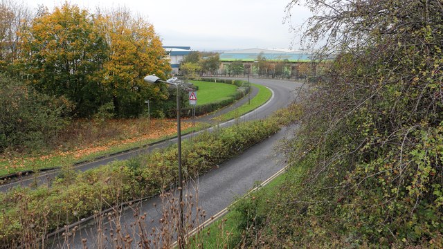
Image: © Alan Walker Taken: 31 Oct 2017
Walking the Five Pits Trail loop around Holmewood and Williamthorpe Image : Previous – (5 of 21) - Next : Image This north-westerly facing photograph was taken from the Devonshire Terrace bridge as it crosses Park Road. Ahead are some of the buildings of the Holmewood Industrial Park, which is built on the site of Williamthorpe Hall and Wood and the subsequent Williamthorpe Colliery. A few metres to the right an access ramp takes the Five Pits Trail back onto the former trackbed of the Great Central Railway to continue toward the ponds and nature reserve at Williamthorpe. See also this photograph by Roger Temple:- Image - - - An OS map surveyed in 1914 and published in 1921 shows that what is now Devonshire Terrace was the original route for Heath Road. At this point a bridge (now replaced by this newer version) carried the road over the tracks of the Great Central Railway. These tracks, part of the railway's Derbyshire Lines, were part of a route from the south, via Tibshelf that continued on toward Staveley with a branch via Chesterfield.
Images are licensed for reuse under creativecommons.org/licenses/by-sa/2.0
Image Location
Latitude
53.192283
Longitude
-1.35009