Replacement bridge at the former Whitegate Station
Introduction
The photograph on this page of Replacement bridge at the former Whitegate Station by Stephen Craven as part of the Geograph project.
The Geograph project started in 2005 with the aim of publishing, organising and preserving representative images for every square kilometre of Great Britain, Ireland and the Isle of Man.

There are currently over 7.5m images from over 14,400 individuals and you can help contribute to the project by visiting https://www.geograph.org.uk
Replacement bridge at the former Whitegate Station
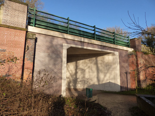
Image: © Stephen Craven Taken: 28 Dec 2017
The bridge deck was replaced in 2014 with a modern concrete structure. At the same time the original abutments were strengthened, resulting in a narrower passage: there were originally two tracks through the bridge but there would now only be room for one, were the railway ever to be reopened. See Image for the bridge before renewal.
Images are licensed for reuse under creativecommons.org/licenses/by-sa/2.0
Image Location
Latitude
53.20775
Longitude
-2.578494