Old Milestone by the A68, south of Castleside
Introduction
The photograph on this page of Old Milestone by the A68, south of Castleside by C Minto as part of the Geograph project.
The Geograph project started in 2005 with the aim of publishing, organising and preserving representative images for every square kilometre of Great Britain, Ireland and the Isle of Man.

There are currently over 7.5m images from over 14,400 individuals and you can help contribute to the project by visiting https://www.geograph.org.uk
Old Milestone by the A68, south of Castleside
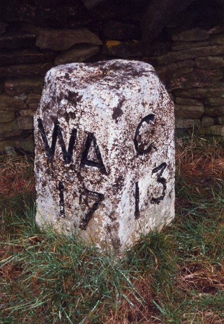
Image: © C Minto Taken: 22 Aug 2004
Carved stone post by the A68, in parish of HEALEYFIELD (DERWENTSIDE District), Castleside, 200m East of Rowley Cottage, South end of village, on the verge near 30 sign on road, on East side of road. WA/C stone, erected by the West Auckland turnpike trust in the 19th century. Inscription reads:- : WA / 17 : : C / 13 : Grade II Listed. List Entry Number:1185969 https://historicengland.org.uk/listing/the-list/list-entry/1185969 Milestone Society National ID: DU_WACO17.
Images are licensed for reuse under creativecommons.org/licenses/by-sa/2.0
Image Location
Latitude
54.830637
Longitude
-1.873956