Willaston Mill
Introduction
The photograph on this page of Willaston Mill by Jeff Buck as part of the Geograph project.
The Geograph project started in 2005 with the aim of publishing, organising and preserving representative images for every square kilometre of Great Britain, Ireland and the Isle of Man.

There are currently over 7.5m images from over 14,400 individuals and you can help contribute to the project by visiting https://www.geograph.org.uk
Willaston Mill
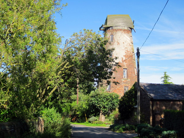
Image: © Jeff Buck Taken: 30 Aug 2017
Willaston Mill on Mill Lane was built in 1800 and was in working condition until around 1930 when its sails were destroyed in a storm. It is now a private residence. Wikipedia https://en.wikipedia.org/wiki/Willaston,_Cheshire_West
Images are licensed for reuse under creativecommons.org/licenses/by-sa/2.0
Image Location
Latitude
53.298354
Longitude
-3.010796