Baildon railway station - south end
Introduction
The photograph on this page of Baildon railway station - south end by Stephen Craven as part of the Geograph project.
The Geograph project started in 2005 with the aim of publishing, organising and preserving representative images for every square kilometre of Great Britain, Ireland and the Isle of Man.

There are currently over 7.5m images from over 14,400 individuals and you can help contribute to the project by visiting https://www.geograph.org.uk
Baildon railway station - south end
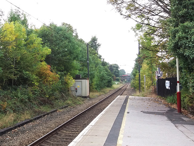
Image: © Stephen Craven Taken: 26 Sep 2017
Compare this view with Ben Brooksbank's similar view of 1961 Image In the intervening 56 years, the track has been singled and the southbound platform taken out of use (probably when the line was electrified in 2002), the siding has also been taken up, and lineside growth now obscures any view to across the Aire valley to the left of the line. The road bridge in Ben's photo is still just visible in the distance.
Images are licensed for reuse under creativecommons.org/licenses/by-sa/2.0
Image Location
Latitude
53.849775
Longitude
-1.754475