Barmill bonded warehouses from the air
Introduction
The photograph on this page of Barmill bonded warehouses from the air by Thomas Nugent as part of the Geograph project.
The Geograph project started in 2005 with the aim of publishing, organising and preserving representative images for every square kilometre of Great Britain, Ireland and the Isle of Man.

There are currently over 7.5m images from over 14,400 individuals and you can help contribute to the project by visiting https://www.geograph.org.uk
Barmill bonded warehouses from the air
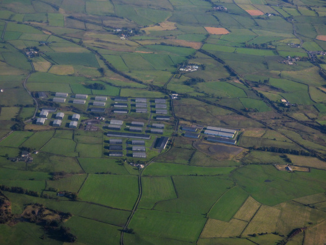
Image: © Thomas Nugent Taken: 25 Sep 2017
The line of the former and now disused Glasgow & Kilmarnock Joint Railway Beith Branch can be seen just beyond the warehouses, with the line of the former and now disused Lanarkshire & Ayrshire Railway beyond it.
Images are licensed for reuse under creativecommons.org/licenses/by-sa/2.0
Image Location
Latitude
55.740123
Longitude
-4.60018