View to the side of West Green Bridge
Introduction
The photograph on this page of View to the side of West Green Bridge by Rose and Trev Clough as part of the Geograph project.
The Geograph project started in 2005 with the aim of publishing, organising and preserving representative images for every square kilometre of Great Britain, Ireland and the Isle of Man.

There are currently over 7.5m images from over 14,400 individuals and you can help contribute to the project by visiting https://www.geograph.org.uk
View to the side of West Green Bridge
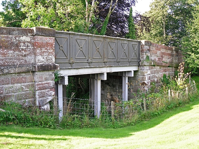
Image: © Rose and Trev Clough Taken: 27 Aug 2016
This was originally a drawbridge over the Carlisle Canal, in operation between 1823-1853. The height of the bridge was raised when the canal was replaced by a railway along the same route (Port Carlisle Railway http://www.cumbria-railways.co.uk/port-carlisle-railway.html ). The line was later extended to Silloth, but closed in 1964. The top of the bridge is shown here Image . West Green Bridge is a Grade II listed building - see Historic England for details https://historicengland.org.uk/listing/the-list/list-entry/1335634 .
Images are licensed for reuse under creativecommons.org/licenses/by-sa/2.0
Image Location


Leaflet Map data © OpenStreetMap
Latitude
54.920214
Longitude
-3.064621