Flats under construction, 44, Canterbury Road
Introduction
The photograph on this page of Flats under construction, 44, Canterbury Road by John Baker as part of the Geograph project.
The Geograph project started in 2005 with the aim of publishing, organising and preserving representative images for every square kilometre of Great Britain, Ireland and the Isle of Man.

There are currently over 7.5m images from over 14,400 individuals and you can help contribute to the project by visiting https://www.geograph.org.uk
Flats under construction, 44, Canterbury Road
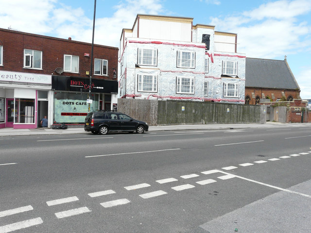
Image: © John Baker Taken: 30 Jul 2017
Planning permission was granted by Thanet District Council under application number F/TH/15/0278 for the “erection of four storey building to accommodate 13 flats with associated parking and landscaping following demolition of existing building”. My previous visit only showed the Image, which had been erected. This was Image after building work had been completed.
Images are licensed for reuse under creativecommons.org/licenses/by-sa/2.0
Image Location
Latitude
51.38443
Longitude
1.366036