Slaithwaite or Hill Top Reservoir, Slaithwaite
Introduction
The photograph on this page of Slaithwaite or Hill Top Reservoir, Slaithwaite by Robin Stott as part of the Geograph project.
The Geograph project started in 2005 with the aim of publishing, organising and preserving representative images for every square kilometre of Great Britain, Ireland and the Isle of Man.

There are currently over 7.5m images from over 14,400 individuals and you can help contribute to the project by visiting https://www.geograph.org.uk
Slaithwaite or Hill Top Reservoir, Slaithwaite
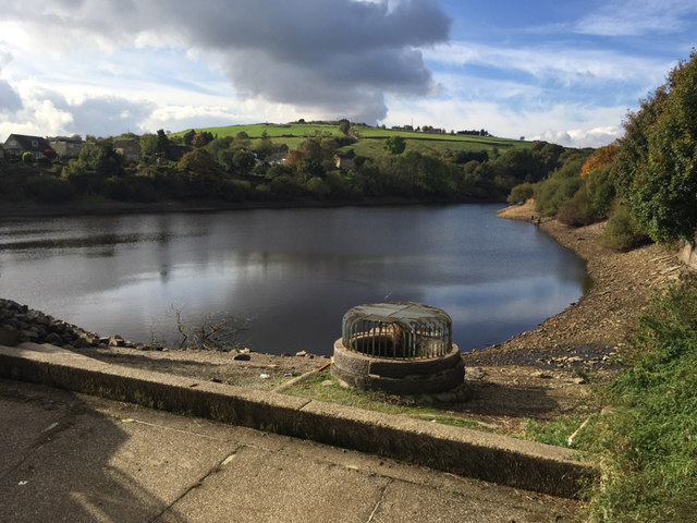
Image: © Robin Stott Taken: 22 Oct 2016
Water level is well below the overflow. The view is from a footbridge over the spillway. Old maps show the outfall feeding mill ponds and mills before passing under the Huddersfield Narrow Canal to join the River Colne, which in turn powered mills. Current information about the reservoir relates to angling, notably for pike. The reservoir features in one of the Milestone Society's walks: http://www.milestonesociety.co.uk/weatherSummerwine/summerwine.html
Images are licensed for reuse under creativecommons.org/licenses/by-sa/2.0
Image Location
Latitude
53.623835
Longitude
-1.888836