Spreading the muck
Introduction
The photograph on this page of Spreading the muck by Jonathan Billinger as part of the Geograph project.
The Geograph project started in 2005 with the aim of publishing, organising and preserving representative images for every square kilometre of Great Britain, Ireland and the Isle of Man.

There are currently over 7.5m images from over 14,400 individuals and you can help contribute to the project by visiting https://www.geograph.org.uk
Spreading the muck
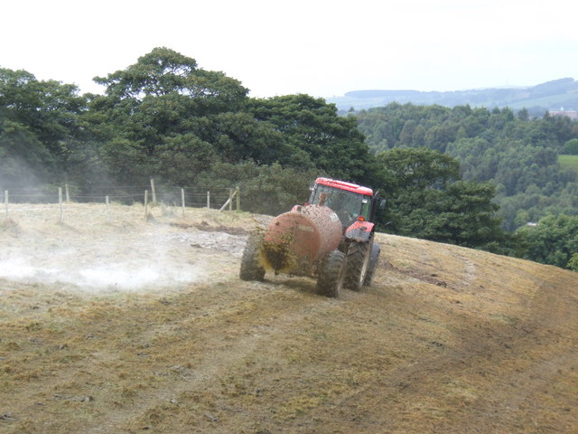
Image: © Jonathan Billinger Taken: 21 Aug 2007
View near Yew Trees Farm east of Cheddleton Heath. The white dust is lime blown up by the passing spreader, having been applied prior to this operation. Lime and muck usually means grassland fertility!
Images are licensed for reuse under creativecommons.org/licenses/by-sa/2.0
Image Location
Latitude
53.078545
Longitude
-2.017126