Location of old coal mine
Introduction
The photograph on this page of Location of old coal mine by Trevor Littlewood as part of the Geograph project.
The Geograph project started in 2005 with the aim of publishing, organising and preserving representative images for every square kilometre of Great Britain, Ireland and the Isle of Man.

There are currently over 7.5m images from over 14,400 individuals and you can help contribute to the project by visiting https://www.geograph.org.uk
Location of old coal mine
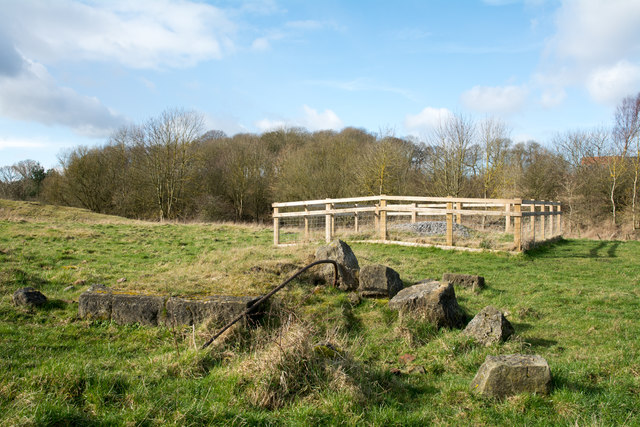
Image: © Trevor Littlewood Taken: 2 Mar 2017
The location, close to the flow of Pittington Beck lies to the east of the Belmont district of Durham city. There's the remains of masonry in the foreground and out of view to the left is an amount of grassed-over mine spoil. The wooden-fenced enclosure is surely the site of a mineshaft, now capped of course.
Images are licensed for reuse under creativecommons.org/licenses/by-sa/2.0
Image Location
Latitude
54.787564
Longitude
-1.509048