
Roadside barn
Introduction
The photograph on this page of Roadside barn by Philip Halling as part of the Geograph project.
The Geograph project started in 2005 with the aim of publishing, organising and preserving representative images for every square kilometre of Great Britain, Ireland and the Isle of Man.

There are currently over 7.5m images from over 14,400 individuals and you can help contribute to the project by visiting https://www.geograph.org.uk
Roadside barn
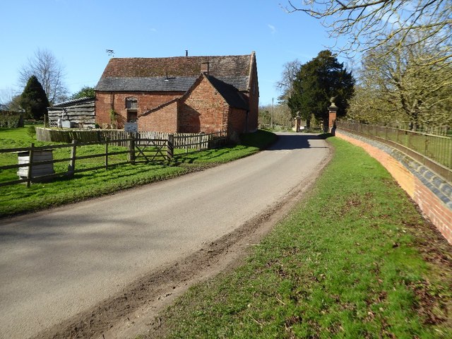
Image: © Philip Halling Taken: 9 Mar 2017
Roadside barn opposite Talton House in Crimscote. The barn is Grade II listed. Historic England description Barn. Late C18. Brick in Flemish garden wall bond with coped gable on stone kneelers and old tile roof. Probably 5 bays. To right, in rebuilt openings, C20 garage doors. To left a small lean-to with plank door. Small 2-light casement to left. Attached to rear left, a sheltershed of probably 3 bays, slightly truncated. Brick, in Flemish garden wall bond with tile roof. Interior: barn noted as having queen strut roof with chamfered tie beams and ogee stops. Collars, purlins and principal rafters original. Source: https://www.historicengland.org.uk/listing/the-list/list-entry/1185869
Images are licensed for reuse under creativecommons.org/licenses/by-sa/2.0
Image Location

Latitude
52.120442
Longitude
-1.651909