Church of St Julitta, Lanteglos
Introduction
The photograph on this page of Church of St Julitta, Lanteglos by Derek Harper as part of the Geograph project.
The Geograph project started in 2005 with the aim of publishing, organising and preserving representative images for every square kilometre of Great Britain, Ireland and the Isle of Man.

There are currently over 7.5m images from over 14,400 individuals and you can help contribute to the project by visiting https://www.geograph.org.uk
Church of St Julitta, Lanteglos
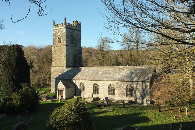
Image: © Derek Harper Taken: 25 Jan 2017
The grade I listed church is described at https://www.historicengland.org.uk/listing/the-list/list-entry/1142729 : "Norman origins with tower added in circa C14". The C19 restoration was by J P St Aubyn. This view is from the road to Helstone.
Images are licensed for reuse under creativecommons.org/licenses/by-sa/2.0
Image Location
Latitude
50.609279
Longitude
-4.70353