The Talbot
Introduction
The photograph on this page of The Talbot by Ian Capper as part of the Geograph project.
The Geograph project started in 2005 with the aim of publishing, organising and preserving representative images for every square kilometre of Great Britain, Ireland and the Isle of Man.

There are currently over 7.5m images from over 14,400 individuals and you can help contribute to the project by visiting https://www.geograph.org.uk
The Talbot
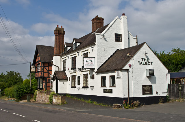
Image: © Ian Capper Taken: 21 Jul 2013
Closed pub on Old Worcester Road. The far wing was originally a house, dating from the 17th Century; the main section was added in the late 18th Century with the nearest extension added in the 20th Century. It closed in 2010 and the building is to be converted to housing along with part of the site. Grade II listed - see https://www.historicengland.org.uk/listing/the-list/list-entry/1215537.
Images are licensed for reuse under creativecommons.org/licenses/by-sa/2.0
Image Location
Latitude
52.334194
Longitude
-2.227413