South Saxons, West St Leonards
Introduction
The photograph on this page of South Saxons, West St Leonards by Patrick Roper as part of the Geograph project.
The Geograph project started in 2005 with the aim of publishing, organising and preserving representative images for every square kilometre of Great Britain, Ireland and the Isle of Man.

There are currently over 7.5m images from over 14,400 individuals and you can help contribute to the project by visiting https://www.geograph.org.uk
South Saxons, West St Leonards
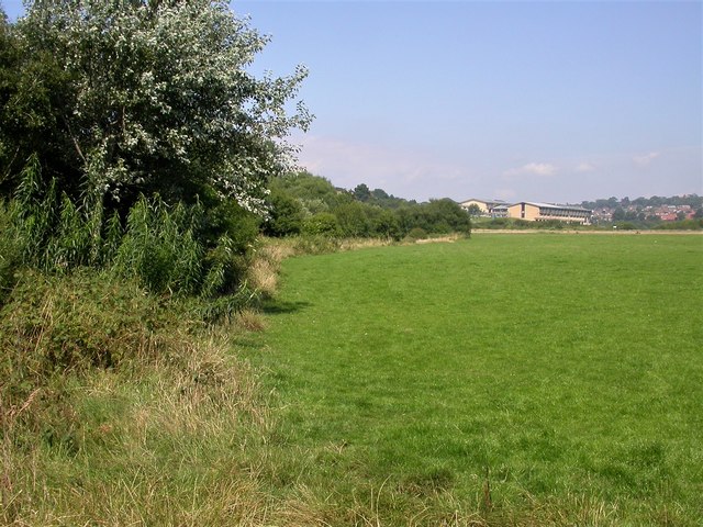
Image: © Patrick Roper Taken: 2 Jul 2004
An open area to the north of the A259 in 2005. The thin, horizontal buff line on the right of the picture is the South Saxons Nature Reserve, a wetland, and the buildings beyond were of Filsham Valley College, now the St. Leonards Academy. The plant on the left between the hawthorn and the brambles is an osier (Salix viminalis), a willow often used in the past for basket making
Images are licensed for reuse under creativecommons.org/licenses/by-sa/2.0
Image Location
Latitude
50.85277
Longitude
0.531418