Village green, Sedlescombe Street
Introduction
The photograph on this page of Village green, Sedlescombe Street by Patrick Roper as part of the Geograph project.
The Geograph project started in 2005 with the aim of publishing, organising and preserving representative images for every square kilometre of Great Britain, Ireland and the Isle of Man.

There are currently over 7.5m images from over 14,400 individuals and you can help contribute to the project by visiting https://www.geograph.org.uk
Village green, Sedlescombe Street
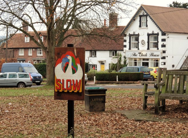
Image: © Patrick Roper Taken: 2 Dec 2016
The sign in the foreground is to warn people about the geese that wander round the green every day. The buildings in the distance are The Clock House, currently a beauticians, formerly a café and a shop. In the centre a house called 'Durud', a Grade II listed 16th century timber-framed building, now faced with weather-boarding and to the left 'Sherrald', an 18th century house also listed Grade II. The meaning of the name 'Durud' I have not been able to find, but 'Sherrald' is a fairly widespread first and family name.
Images are licensed for reuse under creativecommons.org/licenses/by-sa/2.0
Image Location
Latitude
50.9334
Longitude
0.53366