Redundant building at the Cumberland Infirmary
Introduction
The photograph on this page of Redundant building at the Cumberland Infirmary by Rose and Trev Clough as part of the Geograph project.
The Geograph project started in 2005 with the aim of publishing, organising and preserving representative images for every square kilometre of Great Britain, Ireland and the Isle of Man.

There are currently over 7.5m images from over 14,400 individuals and you can help contribute to the project by visiting https://www.geograph.org.uk
Redundant building at the Cumberland Infirmary
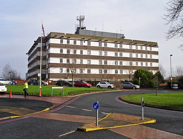
Image: © Rose and Trev Clough Taken: 16 Feb 2015
This block was built in the 1970s as an extension to the old Cumberland Infirmary http://www.geograph.org.uk/photo/2646570 . When the new infirmary http://www.geograph.org.uk/photo/74610 opened in 2000, nearly all functions were shifted across from here. Apart from a few services on the ground floor, the building appears to have been unused ever since. Information update : the building was demolished in 2018-2019.
Images are licensed for reuse under creativecommons.org/licenses/by-sa/2.0
Image Location
Latitude
54.896309
Longitude
-2.956712