Southbourne: footpath I14 passes new school buildings
Introduction
The photograph on this page of Southbourne: footpath I14 passes new school buildings by Chris Downer as part of the Geograph project.
The Geograph project started in 2005 with the aim of publishing, organising and preserving representative images for every square kilometre of Great Britain, Ireland and the Isle of Man.

There are currently over 7.5m images from over 14,400 individuals and you can help contribute to the project by visiting https://www.geograph.org.uk
Southbourne: footpath I14 passes new school buildings
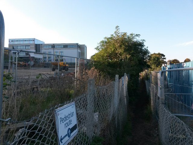
Image: © Chris Downer Taken: 22 Oct 2016
This public footpath from Hengistbury Road (behind us) leads to Sunnylands Avenue by crossing the grounds of St. Peter's School - it forms a boundary between the main school site (left) and its playing fields (right). The school is undergoing major building works, with considerable expansion, and as such there is a lot of temporary fencing between the works compound, which is accessed from just behind us, and the school whose new buildings we see on the left. See Image for the approach to Hengistbury Road behind us, and Image for the next view on the path ahead, with links to further photos along the route, and continuing paths heading to Southlands Avenue and Belle Vue Road.
Images are licensed for reuse under creativecommons.org/licenses/by-sa/2.0
Image Location
Latitude
50.723656
Longitude
-1.790704