Gordonstoun House
Introduction
The photograph on this page of Gordonstoun House by Anne Burgess as part of the Geograph project.
The Geograph project started in 2005 with the aim of publishing, organising and preserving representative images for every square kilometre of Great Britain, Ireland and the Isle of Man.

There are currently over 7.5m images from over 14,400 individuals and you can help contribute to the project by visiting https://www.geograph.org.uk
Gordonstoun House
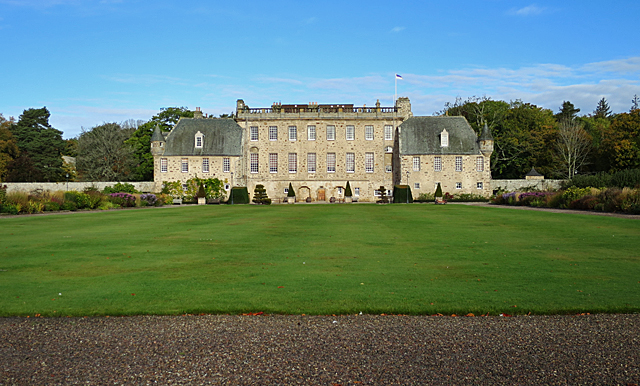
Image: © Anne Burgess Taken: 18 Oct 2016
The house dates back in part to the sixteenth century, but the present elevation is mainly 18th century. It is the centre of Gordonstoun School. See https://canmore.org.uk/site/16143/gordonstoun-house for details.
Images are licensed for reuse under creativecommons.org/licenses/by-sa/2.0
Image Location
Latitude
57.703107
Longitude
-3.370358