Edwinstowe Crossroads, Notts.
Introduction
The photograph on this page of Edwinstowe Crossroads, Notts. by David Hallam-Jones as part of the Geograph project.
The Geograph project started in 2005 with the aim of publishing, organising and preserving representative images for every square kilometre of Great Britain, Ireland and the Isle of Man.

There are currently over 7.5m images from over 14,400 individuals and you can help contribute to the project by visiting https://www.geograph.org.uk
Edwinstowe Crossroads, Notts.
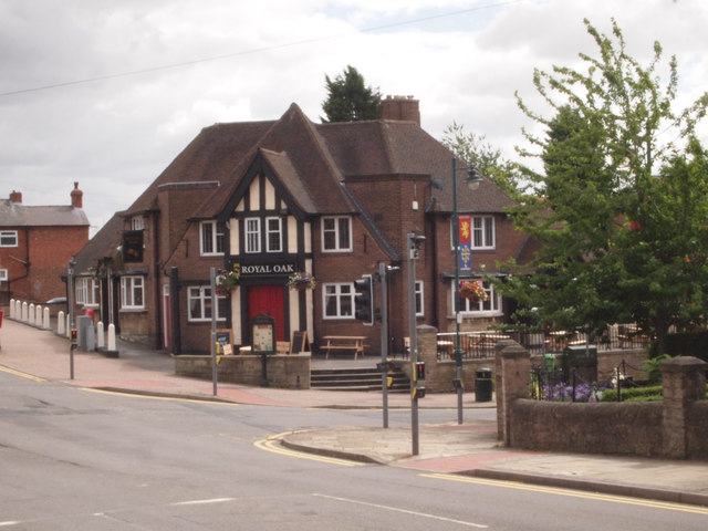
Image: © David Hallam-Jones Taken: 8 Aug 2016
The Royal Oak public house, and opposite, part of the boundary wall of the town's small war memorial garden. Between the two of these High Street - the main shopping street - descends gently downhill. Ollerton Road (the A6075) - the main road between Mansfield Woodhouse and Ollerton (off to the left of the image) - is seen in the forefront of the picture.
Images are licensed for reuse under creativecommons.org/licenses/by-sa/2.0
Image Location
Latitude
53.195059
Longitude
-1.064602