Breamore Mill
Introduction
The photograph on this page of Breamore Mill by Derek Harper as part of the Geograph project.
The Geograph project started in 2005 with the aim of publishing, organising and preserving representative images for every square kilometre of Great Britain, Ireland and the Isle of Man.

There are currently over 7.5m images from over 14,400 individuals and you can help contribute to the project by visiting https://www.geograph.org.uk
Breamore Mill
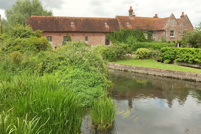
Image: © Derek Harper Taken: 16 Jul 2016
From a different angle to Image], showing more of the mill house on the right https://historicengland.org.uk/listing/the-list/list-entry/1350952 . The water mill is described at https://historicengland.org.uk/listing/the-list/list-entry/1094927 . In the foreground, a water channel from the left is joining the union of the mill races.
Images are licensed for reuse under creativecommons.org/licenses/by-sa/2.0
Image Location
Latitude
50.956523
Longitude
-1.770156