Zara Indian Restaurant, the Mayland Mill
Introduction
The photograph on this page of Zara Indian Restaurant, the Mayland Mill by Stefan Czapski as part of the Geograph project.
The Geograph project started in 2005 with the aim of publishing, organising and preserving representative images for every square kilometre of Great Britain, Ireland and the Isle of Man.

There are currently over 7.5m images from over 14,400 individuals and you can help contribute to the project by visiting https://www.geograph.org.uk
Zara Indian Restaurant, the Mayland Mill
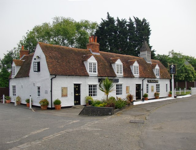
Image: © Stefan Czapski Taken: 11 Jun 2016
Perhaps an unexpected use for a listed building in a rural situation. The building certainly appears extremely smartly kept. According to the listing, the building started off as a row of cottages before becoming a pub. http://www.britishlistedbuildings.co.uk/en-117400-the-mayland-mill-public-house-mayland-es#.V12gTCghzo4 How the 'mill' name came about remains a puzzle. If I'm right, then the building once stood much closer to the roadway. What seems to have happened is that the road has been re-aligned - a sharp bend being replaced by a curve of greater radius. Elsewhere, the ironing-out of a bend often means the old roadway is left to serve as a lay-by. Here, it provides an access road and parking space for the restaurant.
Images are licensed for reuse under creativecommons.org/licenses/by-sa/2.0
Image Location
Latitude
51.679961
Longitude
0.772601