Most Holy Trinity, Jamaica Road
Introduction
The photograph on this page of Most Holy Trinity, Jamaica Road by Stephen Richards as part of the Geograph project.
The Geograph project started in 2005 with the aim of publishing, organising and preserving representative images for every square kilometre of Great Britain, Ireland and the Isle of Man.

There are currently over 7.5m images from over 14,400 individuals and you can help contribute to the project by visiting https://www.geograph.org.uk
Most Holy Trinity, Jamaica Road
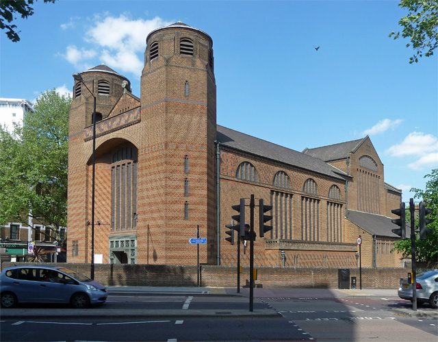
Image: © Stephen Richards Taken: 27 May 2013
Rebuilt by H.S. Goodhart-Rendel in 1960 - although planning must have started earlier as he died in 1959 - after Kempthorne's 1830s original was destroyed by bombing. Probably fair to say that Goodhart-Rendel's interesting building owes little to its predecessor. Grade II* listed.
Images are licensed for reuse under creativecommons.org/licenses/by-sa/2.0
Image Location
Latitude
51.500023
Longitude
-0.072181