Manchester Ship Canal, Approaching Old Quay Swing Bridge
Introduction
The photograph on this page of Manchester Ship Canal, Approaching Old Quay Swing Bridge by David Dixon as part of the Geograph project.
The Geograph project started in 2005 with the aim of publishing, organising and preserving representative images for every square kilometre of Great Britain, Ireland and the Isle of Man.

There are currently over 7.5m images from over 14,400 individuals and you can help contribute to the project by visiting https://www.geograph.org.uk
Manchester Ship Canal, Approaching Old Quay Swing Bridge
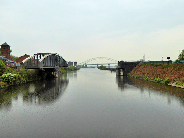
Image: © David Dixon Taken: 11 May 2016
The bridge, which is grade II-listed (Historic England List Entry Number: 1326262 http://www.heritagegateway.org.uk/Gateway/Results_Single.aspx?uid=1326262&resourceID=5 Heritage Gateway), connects Runcorn with Wigg Island. It is operated from the south bank by means of a hydraulic system. It dates from ca1894 when the canal was opened.
Images are licensed for reuse under creativecommons.org/licenses/by-sa/2.0
Image Location
Latitude
53.343783
Longitude
-2.721225