Approach to St Mary the Virgin Church, Tilty
Introduction
The photograph on this page of Approach to St Mary the Virgin Church, Tilty by Marathon as part of the Geograph project.
The Geograph project started in 2005 with the aim of publishing, organising and preserving representative images for every square kilometre of Great Britain, Ireland and the Isle of Man.

There are currently over 7.5m images from over 14,400 individuals and you can help contribute to the project by visiting https://www.geograph.org.uk
Approach to St Mary the Virgin Church, Tilty
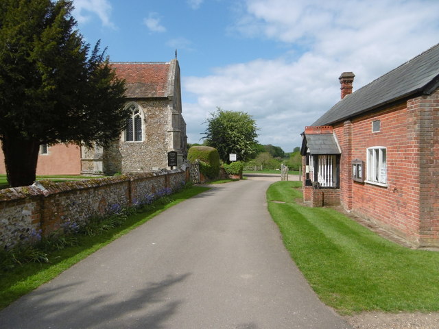
Image: © Marathon Taken: 14 May 2016
The church of St Mary the Virgin at Tilty is delightful, and so is the approach to it from the road. The church was once connected with the nearby Cistercian abbey. The nave of the church is Early English. The south porch is probably 17th century. The belfry and cupola are probably from the 18th century. The chancel was added early in the 14th century which Pevsner describes as "taller, wider and much more ambitious, the gift of a rich man.. It is in the sumptuous style of the moment."
Images are licensed for reuse under creativecommons.org/licenses/by-sa/2.0
Image Location
Latitude
51.913956
Longitude
0.325009