Construction site, Totnes
Introduction
The photograph on this page of Construction site, Totnes by Derek Harper as part of the Geograph project.
The Geograph project started in 2005 with the aim of publishing, organising and preserving representative images for every square kilometre of Great Britain, Ireland and the Isle of Man.

There are currently over 7.5m images from over 14,400 individuals and you can help contribute to the project by visiting https://www.geograph.org.uk
Construction site, Totnes
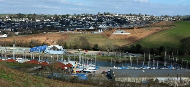
Image: © Derek Harper Taken: 28 Feb 2016
A clearer view than in Image of the site of new housing between Steamer Quay and Weston Lane. The light blue building on the left by the river is the clubhouse of the Dart Totnes Amateur Rowing Club. The adjacent dark blue building, Seymour Wharf, contains business units.
Images are licensed for reuse under creativecommons.org/licenses/by-sa/2.0
Image Location
Latitude
50.42577
Longitude
-3.677633