A cycle route?
Introduction
The photograph on this page of A cycle route? by Adam C Snape as part of the Geograph project.
The Geograph project started in 2005 with the aim of publishing, organising and preserving representative images for every square kilometre of Great Britain, Ireland and the Isle of Man.

There are currently over 7.5m images from over 14,400 individuals and you can help contribute to the project by visiting https://www.geograph.org.uk
A cycle route?
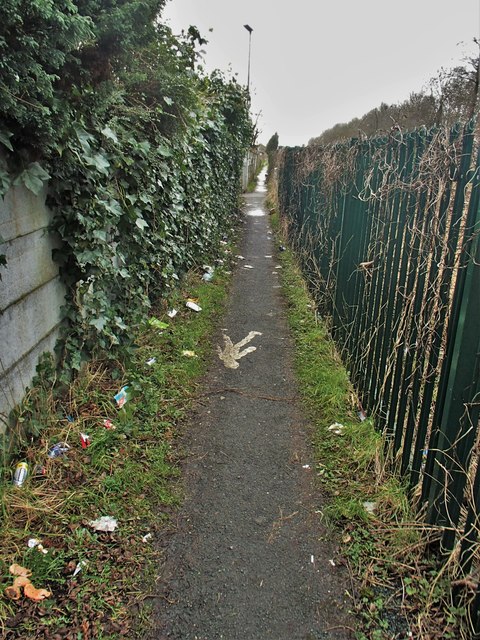
Image: © Adam C Snape Taken: 21 Feb 2016
This path is a useful pedestrian shortcut between businesses on Walton Summit Industrial Estate and the large suburban village of Bamber Bridge. It is also notable for being a very poor quality cycle route. By this point on the route I think all pretence of providing a cycle route had been abandoned. Not safe to ride and too narrow to even push a bike alongside. Too narrow even for the painted man symbol. To top it all off there's an unsigned, blind, right-angled turn just ahead. Previous photo: Image
Images are licensed for reuse under creativecommons.org/licenses/by-sa/2.0
Image Location
Latitude
53.726361
Longitude
-2.65425