Wray Common Windmill
Introduction
The photograph on this page of Wray Common Windmill by Ian Capper as part of the Geograph project.
The Geograph project started in 2005 with the aim of publishing, organising and preserving representative images for every square kilometre of Great Britain, Ireland and the Isle of Man.

There are currently over 7.5m images from over 14,400 individuals and you can help contribute to the project by visiting https://www.geograph.org.uk
Wray Common Windmill
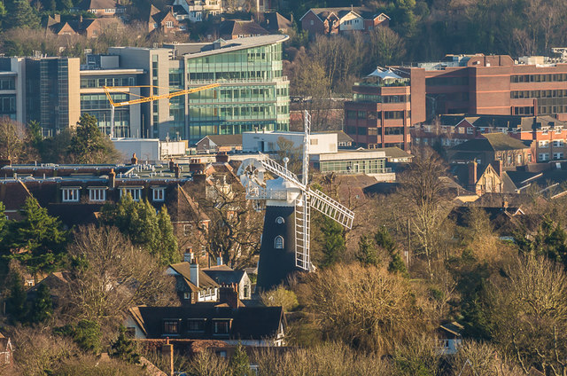
Image: © Ian Capper Taken: 15 Jan 2016
A telephoto view of Wray Common Windmill (see Image) from the slopes of Reigate Hill, with office blocks in central Redhill in the background, RedCentral and Kingsgate on the left (see Image) and Bridge Gate on the right (see Image).
Images are licensed for reuse under creativecommons.org/licenses/by-sa/2.0
Image Location
Latitude
51.244815
Longitude
-0.18334