Berry Hill Lane, Mansfield, Notts.
Introduction
The photograph on this page of Berry Hill Lane, Mansfield, Notts. by David Hallam-Jones as part of the Geograph project.
The Geograph project started in 2005 with the aim of publishing, organising and preserving representative images for every square kilometre of Great Britain, Ireland and the Isle of Man.

There are currently over 7.5m images from over 14,400 individuals and you can help contribute to the project by visiting https://www.geograph.org.uk
Berry Hill Lane, Mansfield, Notts.
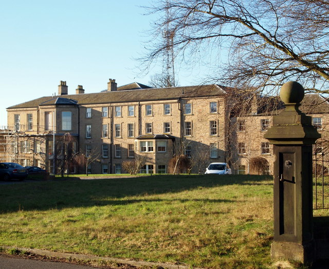
Image: © David Hallam-Jones Taken: 15 Jan 2016
This wing, on the west side of the Grade II-listed former Berry Hill Hall, is seen from Berry Hill Lane. It formed part of a mid-late C18th country house but has C19th and C20th additions. In 1924 the premises were opened as a miners’ convalescent home by Mr. John Bingley. Later on, between 1953-1990, it was owned and managed by the NHS. Parts of the site are still in the process of being converted into luxury apartments. Berry Hill Park, at the rear of this residential complex, can be reached via a pedestrian gate to the photographer's left. The A60 (the main Mansfield-Nottingham road) is a 10 minutes walk away on the photographer's right.
Images are licensed for reuse under creativecommons.org/licenses/by-sa/2.0
Image Location
Latitude
53.130639
Longitude
-1.178844