Restored parish boundary stone, Faringdon Road
Introduction
The photograph on this page of Restored parish boundary stone, Faringdon Road by Roger Templeman as part of the Geograph project.
The Geograph project started in 2005 with the aim of publishing, organising and preserving representative images for every square kilometre of Great Britain, Ireland and the Isle of Man.

There are currently over 7.5m images from over 14,400 individuals and you can help contribute to the project by visiting https://www.geograph.org.uk
Restored parish boundary stone, Faringdon Road
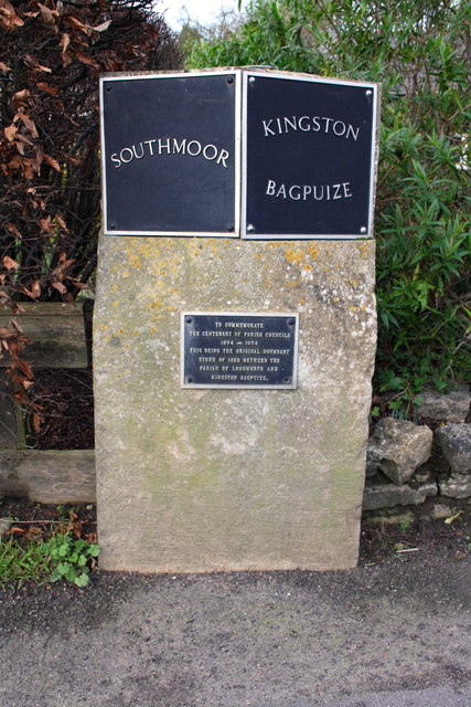
Image: © Roger Templeman Taken: 8 Jan 2016
The plaque reads: TO COMMEMORATE THE CENTENARY OF PARISH COUNCILS 1894-1994 THIS BEING THE ORIGINAL BOUNDARY STONE OF 1822 BETWEEN THE PARISH OF LONGWORTH AND KINGSTON BAGPUIZE
Images are licensed for reuse under creativecommons.org/licenses/by-sa/2.0
Image Location
Latitude
51.681161
Longitude
-1.417025