Pengersick Castle
Introduction
The photograph on this page of Pengersick Castle by Richard Law as part of the Geograph project.
The Geograph project started in 2005 with the aim of publishing, organising and preserving representative images for every square kilometre of Great Britain, Ireland and the Isle of Man.

There are currently over 7.5m images from over 14,400 individuals and you can help contribute to the project by visiting https://www.geograph.org.uk
Pengersick Castle
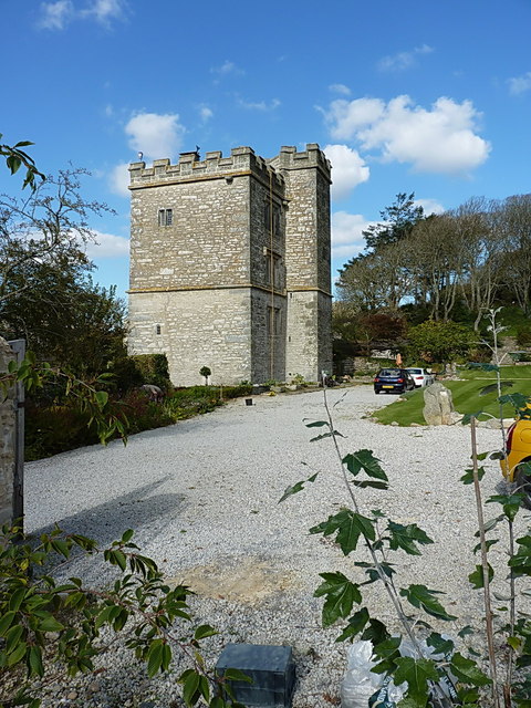
Image: © Richard Law Taken: 14 Oct 2015
Holding a Grade I-listed status, this is fortified manor house dating from the early 1500s, although the site shows evidence of earlier buildings. Although there were extensive alterations and restoration in 1968, much remains of the original building and layout, and the listing on http://www.britishlistedbuildings.co.uk/en-65781-pengersick-castle-breage-#.Vi8wz37hCM8 describes these in detail, including many of the defensive features that survive in the stonework and the interior.
Images are licensed for reuse under creativecommons.org/licenses/by-sa/2.0
Image Location
Latitude
50.10643
Longitude
-5.383277