
Signs near the former Twenty station
Introduction
The photograph on this page of Signs near the former Twenty station by Marathon as part of the Geograph project.
The Geograph project started in 2005 with the aim of publishing, organising and preserving representative images for every square kilometre of Great Britain, Ireland and the Isle of Man.

There are currently over 7.5m images from over 14,400 individuals and you can help contribute to the project by visiting https://www.geograph.org.uk
Signs near the former Twenty station
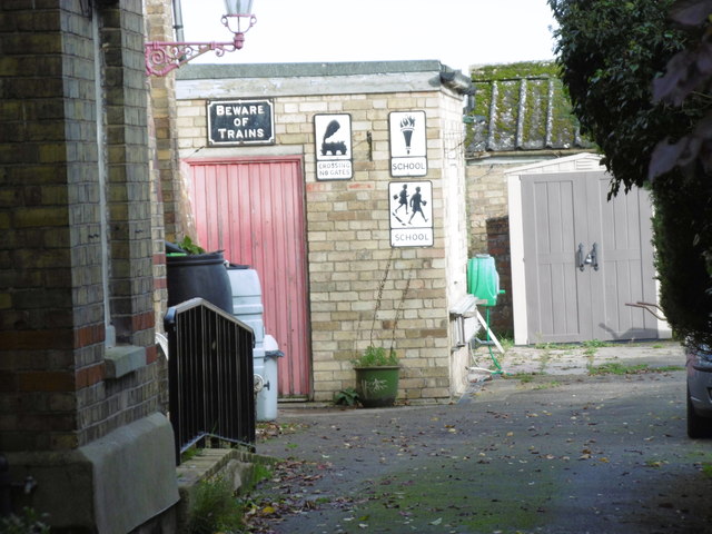
Image: © Marathon Taken: 25 Oct 2015
The Midland & Great Northern Joint Railway began as a series of locally promoted lines built to serve rural areas. The Spalding & Bourne Railway opened on 1st August 1866. Mergers over the years created a sprawling network which was unified in 1893. It had 186 route miles, stretching from Peterborough and Little Bytham near Bourne in the west to Great Yarmouth, Norwich and Cromer in the east. Most of its route was single track with passing places at stations. Almost all of the M&GN closed on 28th February 1959 including the line here to passengers, although the line remained opened for goods until 1964. Twenty is a tiny hamlet on the road between Bourne and Spalding. Twenty station opened with the line on 1st August 1866 and closed permanently on 2nd March 1959. It is now used by a double glazing company. This view is of the yard of a nearby house and of the signs which were presumably once in use locally.
Images are licensed for reuse under creativecommons.org/licenses/by-sa/2.0
Image Location

Latitude
52.769761
Longitude
-0.290063