Steine Street, Brighton
Introduction
The photograph on this page of Steine Street, Brighton by Simon Carey as part of the Geograph project.
The Geograph project started in 2005 with the aim of publishing, organising and preserving representative images for every square kilometre of Great Britain, Ireland and the Isle of Man.

There are currently over 7.5m images from over 14,400 individuals and you can help contribute to the project by visiting https://www.geograph.org.uk
Steine Street, Brighton
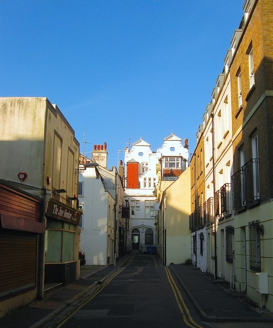
Image: © Simon Carey Taken: 11 Oct 2015
A narrow residential street that runs between Marine Parade and St james's Street and was constructed in the late 1770s. On the western side to the left is a former pub, the Three and Ten which was previously known as the Queen's Head whose pub sign displayed a portait of Freddie Mercury for a brief period in the 1990s. The houses on the right, the eastern side, were built in 1986 on the site of a former Southdown bus depot which had occupied the spot from 1916. To negotitae the narrow streets the buses would enter via Manchester Street and leave the depot in Steine Street. Southdown transferred most of its operations to an expanded site in Freshfield Road in the 1960s with this site just used for coaches until its closure. See https://www.flickr.com/photos/30999979@N05/16196948672 for an image taken in 1976.
Images are licensed for reuse under creativecommons.org/licenses/by-sa/2.0
Image Location
Latitude
50.820556
Longitude
-0.136079