Queensway, Brighton
Introduction
The photograph on this page of Queensway, Brighton by Simon Carey as part of the Geograph project.
The Geograph project started in 2005 with the aim of publishing, organising and preserving representative images for every square kilometre of Great Britain, Ireland and the Isle of Man.

There are currently over 7.5m images from over 14,400 individuals and you can help contribute to the project by visiting https://www.geograph.org.uk
Queensway, Brighton
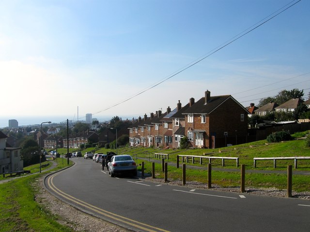
Image: © Simon Carey Taken: 11 Oct 2015
The road runs northwards as a continuation of Sutherland Road and ends at Fredshfield Road next to the racecourse. It was laid out around 1953 as the main arterial route through a new council estate built in Bakers Bottom that was given the name Craven Vale. This view looks south west towards the sea and distant i360 under construction.
Images are licensed for reuse under creativecommons.org/licenses/by-sa/2.0
Image Location
Latitude
50.826911
Longitude
-0.117366