Moreton-in Marsh Airfield
Introduction
The photograph on this page of Moreton-in Marsh Airfield by M J Richardson as part of the Geograph project.
The Geograph project started in 2005 with the aim of publishing, organising and preserving representative images for every square kilometre of Great Britain, Ireland and the Isle of Man.

There are currently over 7.5m images from over 14,400 individuals and you can help contribute to the project by visiting https://www.geograph.org.uk
Moreton-in Marsh Airfield
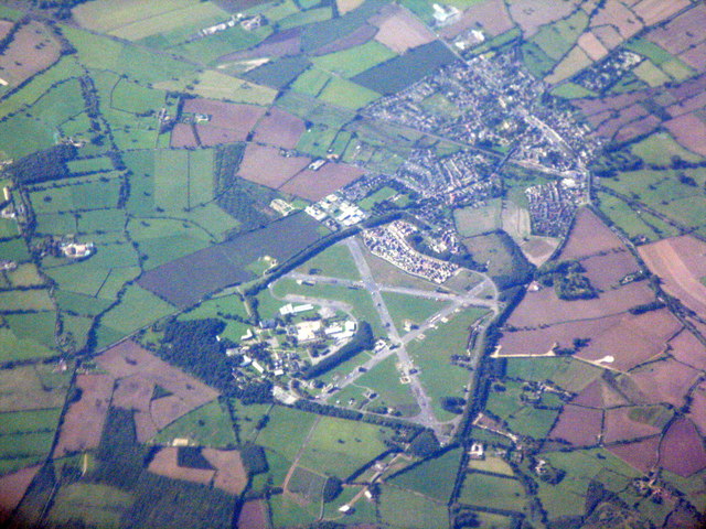
Image: © M J Richardson Taken: 26 Sep 2015
An aerial view from the northeast. The large complex to the left is the Fire Service Technical College, and the various buildings along the three runways are all part of the college as well. They represent various types of buildings and are designed to be frequently set alight for the training of fire-fighters.
Images are licensed for reuse under creativecommons.org/licenses/by-sa/2.0
Image Location
Latitude
51.994124
Longitude
-1.68391