Oxford Mills
Introduction
The photograph on this page of Oxford Mills by Gerald England as part of the Geograph project.
The Geograph project started in 2005 with the aim of publishing, organising and preserving representative images for every square kilometre of Great Britain, Ireland and the Isle of Man.

There are currently over 7.5m images from over 14,400 individuals and you can help contribute to the project by visiting https://www.geograph.org.uk
Oxford Mills
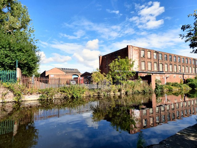
Image: © Gerald England Taken: 24 Aug 2015
Oxford Mills, alongside the Ashton Canal was built in 1845 by Thomas Mason. During the Cotton Famine of the 1860s, his son, Hugh Mason, kept the workforce employed at his own expense. The 1.32 acre site comprises of a number of buildings of differing ages and sizes adapted over the years to meet the specialist needs of the laundry on site, together with a large tarmacadam yard used for parking by delivery and service vehicles is presently (August 2015) for sale.
Images are licensed for reuse under creativecommons.org/licenses/by-sa/2.0
Image Location
Latitude
53.479489
Longitude
-2.103477